
Finding Dakota County Residents From a Name or Address
Dakota County has no single official roll of every resident. The strongest starting point is the fact you can match without guessing. A street address belongs first in the Dakota County Property Information Search, which matches an address or Parcel ID to a property card. A full name can be checked through the statewide Minnesota Court Records Online interface, a historical collection, or the exact-field Find My Registration service. None of those sources is a list of all people at an address.
Use the results as separate evidence, not as a shortcut to identity. The property card identifies an owner of record and a tax-mailing contact. A voter confirmation is limited to an exact registration query. Court and archival results connect a name to a stated role or historical event. A renter, household member, protected voter, or Safe at Home participant may not appear, so a missing result must never be treated as proof that a person is absent from Dakota County.
- Normalize an address in the county property search, then save the Parcel ID, municipality, and the date checked.
- Read the owner, situs, and mailing fields as property relationships, not an occupancy list.
- For a recorded land trail, use the parcel details and legal description in RecordEASE.
- For an exact current registration question, use the Secretary of State lookup with the required name, date of birth, and address fields.
- For an older household, move to the library, Minnesota Historical Society, or Dakota County Historical Society and preserve the collection year.
Note: A Dakota County residents directory search works best when each result is labeled by its actual source relationship and date.
Dakota County Offices Behind Resident Records
Several custodians hold pieces of the Dakota County residents directory trail. Property Taxation & Records keeps property cards and recorded land documents. Dakota County District Court Administration holds court files, while MCRO is the statewide remote route. The Elections Office administers local election activity, and the Minnesota Secretary of State controls the registration lookup and voter-list request process. The county library, DCHS, and MNHS are the practical route when the question is historical rather than current.
Dakota County Property Search
Address or Parcel ID
Countywide parcel records
651-438-4576
Dakota County Parcel Cards Start With an Address
The county property tool is the clearest address-to-parcel route. Its public help describes full or partial address searching, Parcel ID entry with or without dashes, and a matching-result list before a card opens. The card can show the owner, mailing address, municipality, tax description, school and watershed districts, plus tax and building panels. It also offers printable property details, tax-statement material, and subdivision-plat links. Capture the selected parcel and the check date before moving on.
The county documents the following public search path. The interface does not document an owner-name search, so a person-first question needs a different record branch.
| Property field | Input or panel | Use it for |
|---|---|---|
| Street address | Full or partial address | Finding the matching parcel |
| Parcel ID | PID, with or without dashes | Reopening a known parcel |
| Property panel | Owner, mailing address, municipality | Recorded property context |
| Tax and building panels | Linked result tabs | Tax and building leads, when displayed |
Property data has a firm boundary. A mailing address may be a tax contact, business, escrow arrangement, or another correspondence route. It does not prove that a person occupies the Dakota County address.
Dakota County Deed Trails and Future Filing Alerts
RecordEASE is the county land-record path for documents tied to a parcel or party. The research observed an abstract computer index beginning July 8, 1993, with separate Abstract and Torrens status queues. Start from a property card, retain the legal description, then identify a current deed and its grantee. The seller, or grantor, becomes the next historic name to test as a prior grantee. Earlier records may require county staff, books or microfilm, DCHS, MNHS, or a title professional.
The county’s Property Watch service looks forward, not backward. It can monitor a name or entity, legal description, and email address for later recording events. Common names can generate broad notices, so a legal description is the more precise enrollment choice.
See the county’s Property Watch page before enrolling in a future-recording alert.
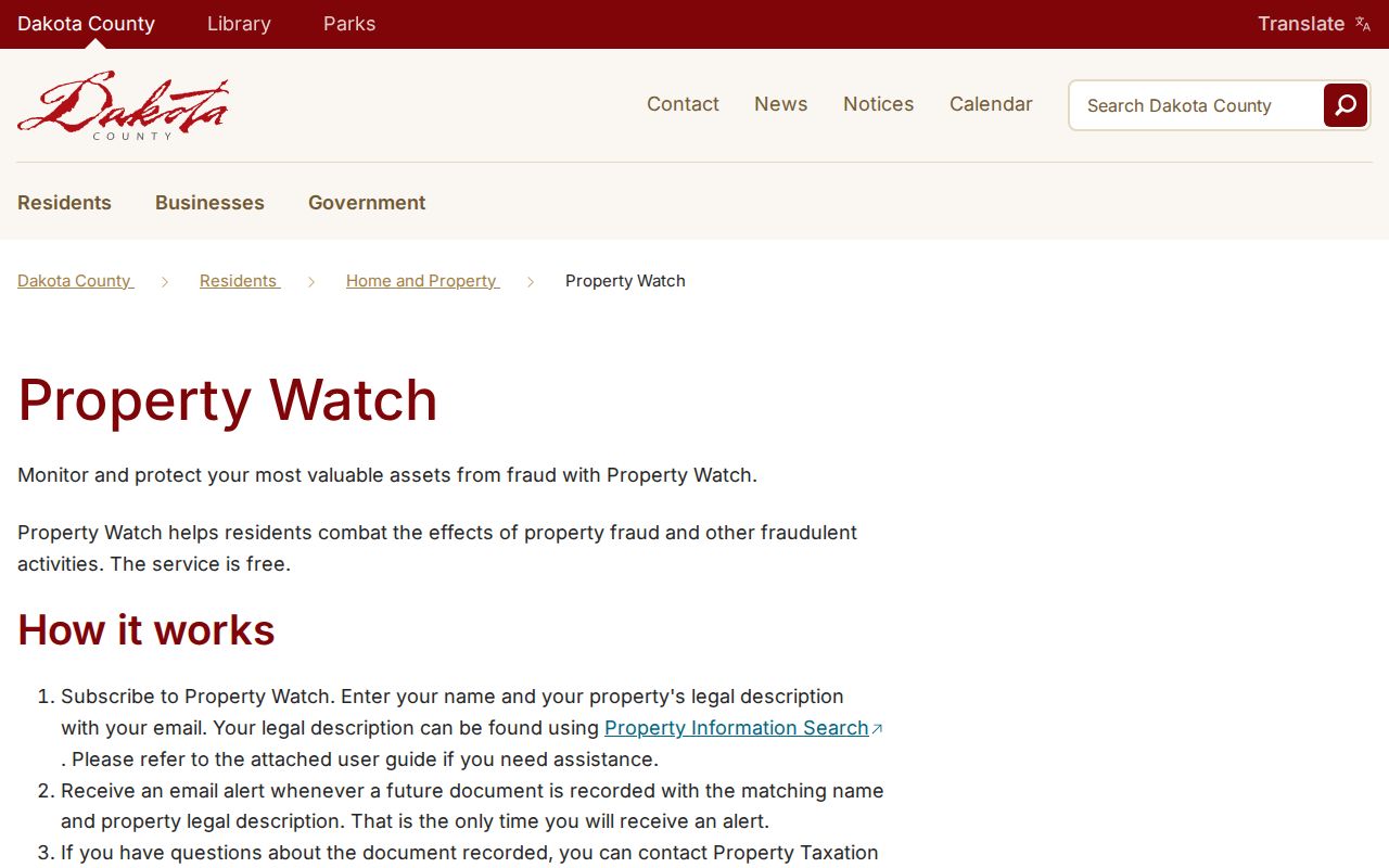
The service can help a property owner monitor newly recorded documents, but it cannot reconstruct a prior chain of title.
- Parcel
- A county identifier for a piece of land, used to join the property card, map, and tax context.
- Index
- A finding aid that points to a document or record; it is not automatically the certified document itself.
- Grantor and grantee
- The recorded transferor and recipient named in a land instrument.
- Criss-cross directory
- An address-ordered directory section that can supply a historical household lead.
Note: Abstract and Torrens land follow different title routes, so preserve the parcel’s title-system indicator before interpreting a deed trail.
Current Dakota County Resident Record Paths
Current Dakota County resident records are relationship-specific. A property card identifies an owner of record and parcel details. RecordEASE identifies parties to recorded documents. MCRO identifies public case participants and events when remote access permits. The state registration tool confirms a specific voter query, while a voter-list product has statutory request, certification, and use limits. Each row below is useful only for the question it actually answers.
| Record path | Relationship shown | Custodian | Access boundary |
|---|---|---|---|
| Property Information Search | Owner, mailing and parcel context | Dakota County | Address or PID, not an occupant roster |
| RecordEASE | Recorded instrument parties | Property Taxation & Records | Account or fees; index begins 07/08/1993 |
| Find My Registration | Exact current registration match | Minnesota Secretary of State | Full identity and address fields required |
| MCRO | Public court party and case event | Minnesota Judicial Branch | Unofficial remote record with exclusions |
| Municipal permit file | Project, applicant, or property role | Relevant city or township | City-by-city access and coverage |
For a one-person question, the Dakota County resident lookup path separates property, court, vital, and historical evidence without treating one result as conclusive. A municipal permit can name an owner, applicant, or contractor, but those roles do not establish present residence. The correct municipality comes from the county parcel card, because Dakota County does not have one countywide permit system.
Dakota County Voter Data Has a Narrow Purpose
Minnesota’s live registration tool is designed to confirm one person’s registration, not to browse a residents directory. It requires first name, last name, full date of birth, city or township, house number, street, and either the ZIP or county route. The system is updated nightly, although a new registration can take up to 14 days to process. A no-match can reflect a spelling, unit, address-path, or timing problem rather than a conclusion about the person.
Public voter-list products under Minn. Stat. §201.091 have different rules. They can include a name, address, birth year, voting history, phone when supplied, and district information, but not full date of birth or listed government identifiers. A requester must meet the statutory conditions, select a product and geography, pay the applicable charge, and follow the permitted-use limits. Safety withholding can intentionally change or suppress an address.
| Required identity | First name, last name, and full date of birth |
|---|---|
| Required location | City or township, house number, street, plus ZIP or county path |
| Optional unit | Apartment or unit field becomes required when selected |
| Response | Registration confirmation and voting information |
Use the official Minnesota voter lookup only for its stated registration-confirmation function.
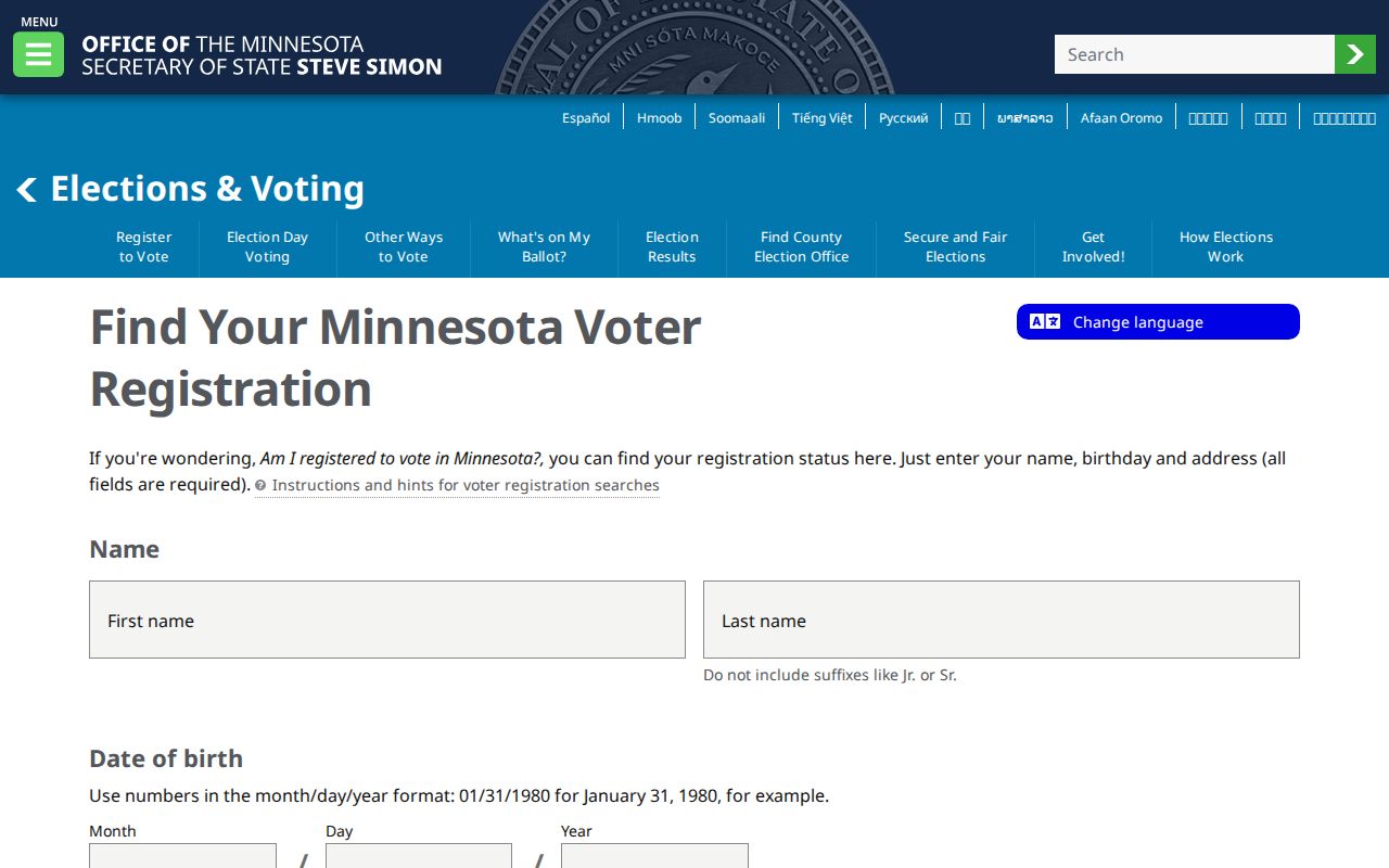
The required field design is why an address alone cannot produce a lawful statewide voter roster.
Dakota County Court and Vital Record Branches
MCRO is the remote starting point for public Minnesota district-court cases. Its observed fields include name, case number, citation, attorney, category, status, filing date, and court location. Remote records are unofficial, public documents before July 1, 2015 are limited, and sensitive case categories can be excluded. Dakota County District Court Administration and courthouse public terminals are the follow-up route for certified copies, locally held paper files, or a result that is not remotely available.
Vital records have another custody split. Dakota County vital offices issue eligible records; the Minnesota Department of Health manages statewide and designated adoption services; a marriage certificate comes from the licensing county and a divorce decree from the granting court. Birth access is restricted under Minn. Stat. §144.225, death records are public while certificate eligibility still matters, and adopted-person access follows the procedure in §144.2252. Historical MNHS indexes help identify a lead but do not replace the underlying record.
Use the Minnesota vital-record forms and fee page to check the correct request route before submitting sensitive paperwork.
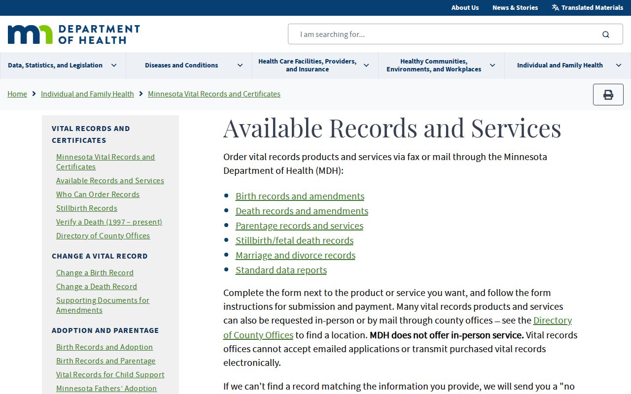
The form route reinforces that an index hit and an eligible certificate request are separate steps.
Dakota County Libraries Keep the Older Resident Trails
For a household that predates current portals, Dakota County Library, DCHS, and MNHS preserve distinct layers. The library’s research list includes HeritageQuest, America’s News, Minnesota News Sources, and Ancestry Library Edition for in-library use. DCHS reports church, cemetery, census, obituary, marriage-announcement, clipping, photograph, and microfilm-newspaper collections. MNHS adds People Records, state census material, telephone-directory finding aids, court-file research, and historical vital-record research.
The stand-out local item is the digitized 1916 Dakota County Atlas and Farm Directory, whose township plats include owners’ names. MNHS’s telephone-directory finding aid begins in 1928 and lists approximately 1,237 volumes and 226 microfiche by city, year, and shelf. Exact city runs must still be checked item by item. The fuller historical shelf belongs on the Dakota County city directory page.
Ask the Dakota County Library or Dakota County Historical Society for a specific year rather than assuming a volume is online.
Dakota County ZIP Codes Do Not Define Neighbors
Dakota County’s ZIP map is useful for postal context, but a postal city is not a legal neighborhood, municipal boundary, or parcel boundary. The county map identifies 23 ZIP codes, including codes associated with Farmington, Hastings, Lakeville, Eagan, Apple Valley, Burnsville, and other county areas. Exact delivery assignments should be confirmed through USPS. County GIS and the municipality shown on a property card are better sources for the civic and parcel context around an address.
A ZIP can narrow a search to the postal question, but it cannot establish who lives together or whether two results are in the same neighborhood. The Dakota County ZIP code directory explains how the county map, USPS lookup, and parcel geography fit together.
Minnesota Data Practices Requests Fill Gaps Carefully
When an identified public record is not online, use a narrow request under the Minnesota Government Data Practices Act, Minn. Stat. ch. 13. Name the custodian, address or parcel where relevant, date range, record type, fields sought, and whether inspection or a copy is wanted. Minnesota generally permits inspection of public government data at reasonable times without an inspection fee, while allowed copy, retrieval, and transmission charges can apply. A denial should state the legal authority.
Start with the county’s public-data request form and department routing when the responsible Dakota County department is known.
A focused request helps staff identify a real record set without inviting assumptions about protected data.
If the request is for your own government data, the county’s data-subject request process requires written information and identity verification and describes a 10-business-day response framework.
That separate process does not turn private government data into a public resident record.
Note: Minnesota’s Safe at Home program and other confidentiality rules can make an address difference intentional rather than an error.
Dakota County’s Three County Seats Affect Old Searches
Dakota County was founded in 1849, and its county seat moved from Kaposia in 1853 to Mendota in 1854 and then Hastings in 1857. The county’s original geography was much larger than it is today. Older records can therefore use a former county-seat label, a township, an unorganized territory, or the historical spelling “Decota.” Retain the display spelling from an index and test a variant instead of silently modernizing the record.
The 1916 atlas, township records, state-census material, and 1928-forward telephone directories make a useful sequence for tracing a Dakota County family or rural parcel across changing place names. River boundaries and municipal movement add another reason to search the historical jurisdiction as well as a modern city name.
Past Dakota County Resident Directory Collections
Historical directories give a dated association, not a guarantee that a person lived at an address for an entire year. A telephone entry can include a name, street number, phone number, or business reference. A criss-cross section can turn the same historical address into an address-ordered lead. Pair that edition with a deed, census, permit, newspaper notice, obituary, probate record, or cemetery source before treating the connection as a strong household trail.
Dakota County’s best documented directory route is MNHS’s telephone-directory finding aid, with 1928-forward city and year entries. The 1916 atlas is especially useful before standardized street addresses because its township plats identify landowners. Dakota County Library staff and the DCHS research desk can help identify the right physical, microfilm, or database source when a desired year has not been digitized.