
Search a Dakota County Street
Whole-street research in Dakota County is a map-and-parcel task, not one public roster. The county property card can connect an address to an owner of record and parcel context, while the map shows where the parcel lies beside the rest of the street. Recorded deeds then explain transactions, and historical sources can supply address-based leads. Keep an evidence table as you go: house number, situs, parcel ID, owner of record, mailing address, municipality, legal description, source, and date checked. A mailing address is where county correspondence goes, not proof that a person lives at the parcel.
- Enter the address in the county Property Information Search and save the matching parcel, situs, owner-of-record, municipality, and date checked.
- Open the parcel in Dakota County GIS, inspect the street segment, and record the parcel IDs for the selected addresses rather than assuming a map label identifies a household.
- Use the parcel’s legal description and recorded parties in RecordEASE to locate the purchase deed, then compare the deed, property card, and plat.
- For a lawful voter task, use the exact state registration route or the certified public-list request process. It is not a free by-street roster.
- For an older address, follow the same street and number through verified telephone-directory years, newspapers, plats, and the 1916 atlas.
Dakota County Property Cards by Address
Dakota County Property Information Search is the primary address-to-parcel route. It accepts an address or Parcel ID, supports a full or partial address, and accepts a PID with or without dashes. A matching list appears before the parcel opens. The result is a property record, not a household list. Its panels can show the owner and mailing address, municipality, tax description, school and watershed districts, tax and building information, plus links to a property-details PDF, tax statement or payment stub, and subdivision plats.
| Search input | Dakota County behavior | Useful next check |
|---|---|---|
| Address | Full or partial address, generally house number and street name | Choose the matching parcel result |
| Parcel ID | PID may be entered with or without dashes | Open Property, Tax, and Building panels |
| Map location | Selected parcel can be tied to the county map | Compare the parcel with the street segment |
The county’s Property Information help illustrates the card and its search path.
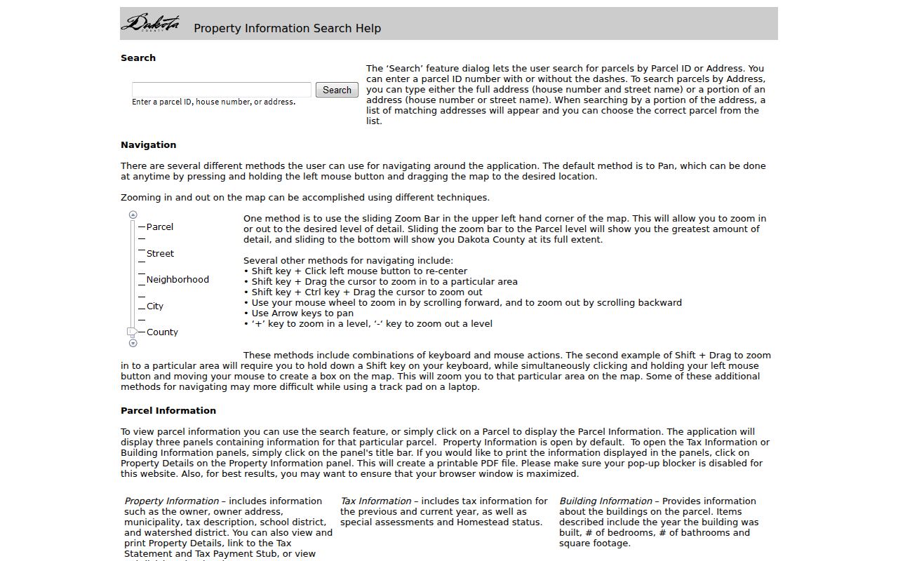
The help material is useful for checking which fields and links are actually present before treating a property-card result as evidence.
Dakota County Street Map Layers
Dakota County Online Property Maps supplies the spatial half of a by-address search. The map catalog accepts city, section, USNG, address, or parcel-ID searches. Its layers include parcels, aerials, contours, roads, parks and trails, floodplain, districts, and other map information, with about 150 layers available through the interactive map. Select a parcel, use its property link or card, then repeat for a separate parcel. Capture the layer name and map date because layer dates and update schedules vary.
For an older legal description, the Public Land Survey layer can help reconcile township or section language with a present parcel. Keep postal city, municipality, and situs as separate fields. A postal label or ZIP does not settle a parcel’s jurisdiction, and a street name does not substitute for a legal description.
Dakota County Recorded Deed Chains
Use the current owner and parcel details as the starting point for a recorded-document trail. RecordEASE is Dakota County’s online land-record system; its abstract computer index reaches back to 07/08/1993 and requires an account with applicable fees. Find the current purchase deed by grantee, identify the seller as grantor, then search that prior grantor as an earlier grantee. At every link, compare legal description, lot and block, plat, document number, and dates. A same-name hit without parcel context is not enough to connect a person to another address.
The RecordEASE sign-in and status page is the source for the online index route.
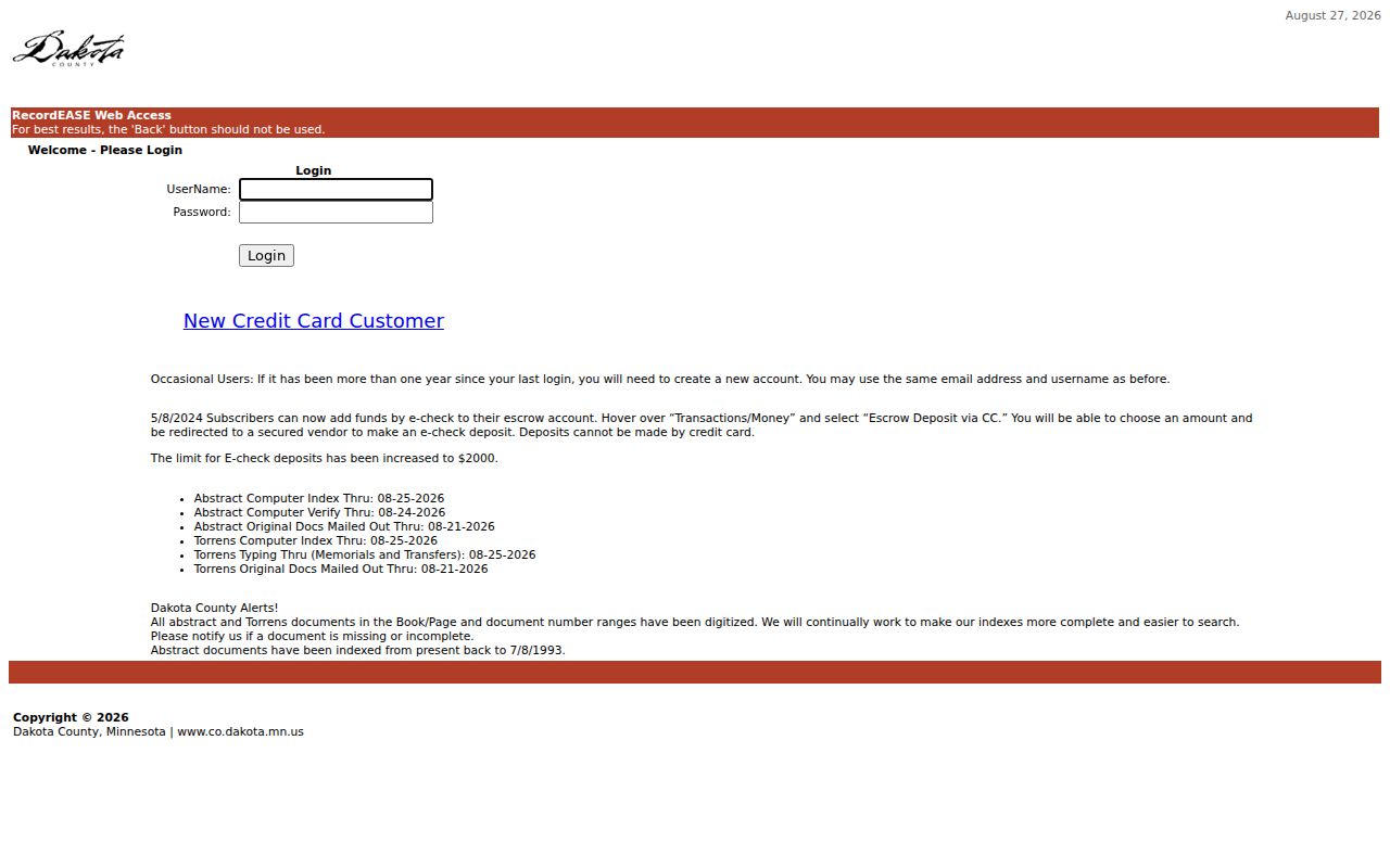
The login screen is a reminder that the recorded-index path is account and fee based, rather than a public whole-street search.
Dakota County Address Record Sources
Each address-keyed source answers a different question. The parcel card supplies tax and ownership context, GIS supplies geometry, and RecordEASE supplies recorded instruments. City permit and planning files can add construction or land-use context, while historical directories may be closer to an occupant question. Read the source label with the result. A deed names parties to an instrument, and a permit names project roles; neither fact alone proves a person’s current presence at an address.
| Address record | Custodian | Street-level value | Access route |
|---|---|---|---|
| Property and tax card | Dakota County | Owner, mailing and situs context, parcel, tax, building, and district fields | Free address/PID search and public terminals |
| GIS parcel layers | Dakota County GIS | Parcel geometry, roads, districts, floodplain, and map context | Interactive viewer; layer dates vary |
| Deed, mortgage, and lien index | Property Taxation & Records / RecordEASE | Parties, instruments, legal descriptions, and dates | Account and fees; abstract index from 07/08/1993 |
| Municipal permits | City or township custodian | Address, project parties, inspections, fees, and parcel clues | Municipality-specific route |
| Telephone and criss-cross sources | MNHS, library, and DCHS | Historical address-to-household or business leads | Catalog, reading room, or database access |
| Voter list | Minnesota SOS and county elections | Statutorily limited public voter fields and voting history | Request, certification, and fee process |
Dakota County Street Voter Route
Minnesota’s Find My Registration is an exact, address-dependent check rather than a browseable street list. It requires first and last name, date of birth, city or township, house number, street, and either a ZIP or county path. An apartment or unit is optional until the unit box is selected. A match confirms registration and provides voting links. A no-match should prompt checks for spelling, unit, ZIP or county path, and processing time, not a claim that someone is unregistered.
Public voter-list products follow a separate request process. Requesters provide contact information, select a geography and product, pay the listed fee, and certify Minnesota voter status and permitted use. Walking lists, detailed voting history, mailing labels, and household labels have different fields and uses. Safety withholding can remove a voter from public display, so even an authorized result is not a complete by-street record.
Dakota County Street Permit Routes
Dakota County does not maintain one building-permit search for every municipality. After the county parcel search identifies the city or township, use that local permit, inspection, planning, or document-management route. Eagan is a documented example: its property permits and information service points to permit searches, scanned construction permits, historic inspection records, and site-survey maps, with stated permit coverage from 1995 forward. Its permit search accepts permit name, address, or permit number. Other Dakota County municipalities must be checked through their own official archives.
Dakota County’s recorded-document purchase instructions show the county route for obtaining a deed or other recorded copy.
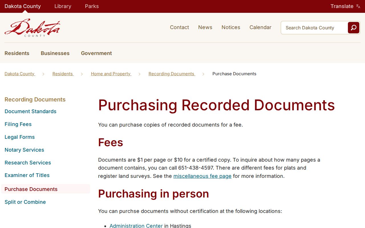
Permit and copy requests are best logged by parcel, address, record type, source, and date, while project parties remain distinct from residents.
Dakota County Deed Copy Options
Older documents need a different route once a RecordEASE search reaches the 07/08/1993 abstract-index boundary. County staff, books or microfilm, Dakota County Historical Society, Minnesota Historical Society, or a title professional may be needed for earlier research. Recorded copies can be requested in person at the Hastings Administration Center, Northern Service Center in West St. Paul, or Western Service Center in Apple Valley. Mail a written request to Property Taxation & Records, Attn. Research, 1590 Highway 55, Hastings, MN 55033.
Dakota County’s recorded-document purchase instructions list non-certified copies at $1 per page and certified copies at $10. The county asks requesters to call for the cost and allows about 24 hours. Note: Confirm the current fee and requested document details with the county before sending payment.
Dakota County Abstract and Torrens
Dakota County uses two title systems. Most county property is Abstract, where a complete title search is needed to establish the chain. Torrens property has a Certificate of Title, with the certificate and its memorials central to the research path. The county property-map layer can identify the title-system context. That distinction matters when a recorded deed search is incomplete or a legal description changes. For a Torrens parcel or a complicated title event, treat the examiner or certificate route as controlling and preserve the parcel identifier with every result.
Dakota County Property Watch Alerts
Property Watch is a forward-looking recording alert, not a historical title search. Sign-up uses a name or entity, legal description, and email, and an alert identifies a matched party name, recording date, document number, and type. A common name can produce broad alerts, so verify every alert against the parcel and legal description before drawing a conclusion. The service is useful for monitoring a known property interest, while the deed chain remains the route for tracing older recorded transfers.
Dakota County Historical Street Leads
Historical street research should not fill gaps with guesses. Read each available directory year around the period, mark missing years, and compare the address with a city plat or historical map before matching it to the present GIS. The MNHS telephone-directory finding aid begins in 1928 and identifies city, year, and shelf number, but the exact local run must be checked item by item. For rural property, the digitized 1916 Dakota County Atlas and Farm Directory preserves township plats with owner names.
DCHS newspapers, clippings, and Sanborn leads can add a dated address reference, especially for Hastings, but an exact map year needs confirmation. Dakota County’s historical record trail can also use former township or jurisdiction language, including the historical “Decota” spelling found in MNHS state-census material.
Dakota County Address Terms
Use the same labels throughout a street table. The county property card and GIS organize land around the parcel and situs, while recorded documents depend on a legal description and historical directories index a street number. Mixing those labels makes a match look firmer than it is.
- Parcel
- A county land unit identified in property and GIS records.
- Situs address
- The physical location assigned to the parcel, distinct from the tax mailing address.
- Plat
- A recorded subdivision drawing that can connect lot and block language to the parcel.
- Criss-cross directory
- An address-indexed directory used to follow a street number through dated editions.
Dakota County Street Directory Limits
A street directory can show parcels, recorded owners, instrument parties, and carefully dated historical leads. It cannot reveal every person at an address. Utility-customer information is not public, DMV address data is restricted under the DPPA, and voter data has statutory limits. Safe at Home and voter safety withholding can deliberately suppress or substitute an address. Absence from one source is not proof that a person is absent from Dakota County or has no connection to a street.
When the goal becomes one person instead of a street, the separate Dakota County resident lookup route helps keep the evidence tied to the correct individual.